Sky-high error in Apple Maps leads drivers onto airport runway
 Well, OK, yes, there were signs saying they shouldn’t be driving along the taxiway.
Then there was the motion-activated gate. That was a little officious, but whatever. They drove through.
There were more signs, and lights, and true, painted markings, and there was, actually, something that suggested that airplanes might share that road and that maybe drivers should not be there at all.
They didn’t turn back, though.
“Don’t worry” they said. “We’re good!”
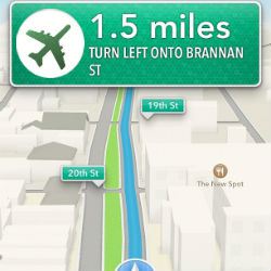
After all, they were using Apple Maps. What could possibly go wrong?
“They must have been persistent,” assistant manager Angie Spear at the Fairbanks International Airport, in the US state of Alaska, told the BBC in the best understatement ever when describing not one, mind you, but two motorists who in the past three weeks have driven not only along the taxiway and through the motion-detection gateway and way, way past all the signs telling them not to be there but also right across one of the runaways – as in, the place where airplanes might squash you and your car like a metal/flesh panini.
According to the Alaska Dispatch, the drivers who followed the directions on their iPhones not only reached airport property, but also crossed the runway and drove right over to the airport ramp side of the passenger terminal.
The drivers were both out-of-towners who apparently trusted their Apple Maps more than signposts telling them to get the heck off the roads they were on.
The mapping application wasn’t telling drivers specifically to drive onto the runway, but it sure made it seem like that was the logical place to go, according to the Alaska Dispatch:
The turn-by-turn directions were specific, using the access route that general aviation pilots use to the East Ramp, which is on the other side of the runway from the main airport terminal.
The map directions concluded by telling drivers to go to Taxiway Bravo, shown as “Taxiway B” on the satellite image in the app. The directions did not tell drivers to cross the main runway used regularly by 737s and other aircraft.
But once drivers reached the taxiway, it was only natural for them to look up and see the terminal on the other side of the runway. So that’s where they drove.
Apple has reportedly issued a temporary fix, so that users searching for directions are told they’re “not available.” The earlier taxiway route no longer shows up.
The airport told the Alaska Dispatch that it had complained to Apple three weeks ago via the local attorney general’s office.
Melissa Osborn, chief of operations at the airport, said the airport was trying to avoid potential future paninis:
We asked them to disable the map for Fairbanks until they could correct it, thinking it would be better to have nothing show up than to take the chance that one more person would do this.
A “lot of legal speak” ensued, Spear told the Alaska Dispatch, but the issue wasn’t fixed until Wednesday, when Apple took directions to the airport off the map, unless users type in the exact street address for the terminal.
In the meantime barricades had been erected to block access to the final stretch of the taxiway.
Sadly, this is par for the course for Apple’s woebegone Maps.
The Maps app has been on the iOS, then iPhone OS, since the first generation of iPhones debuted in 2007. Up until the version released on 19 September 2012, however, Apple Maps was actually powered by Google Maps.
You know, Google Maps? The location app that takes drivers along a different, longer route to the airport’s car park? Without telling them to drive where they might get flattened? That one.
Since it debuted, Apple Maps has been the Rodney Dangerfield of maps apps: it gets no respect, but for very good reasons.
A selection from a vast collection of incidents:
- Relocated landmarks, buildings in the middle of rivers, missing train stations, and relocated towns, according to Macworld.
- The wrong location listed for the Apple Store in Sydney, Australia, as The Register reported.
- Marking an entire city as a hospital, misclassifying a nursery as an airport, and identifying the nearest gas station to be as far as 76 miles away from the user’s location, as Gizmodo reported.
It’s all fun and games (mostly Hide and Seek) until somebody gets hurt.
Typically, Naked Security writes about information security, but in this most recent case of Apple Maps and the airport runway incidents, it’s a case of disinformation leading to serious, tangible, real-world security issues.
I don’t mean to be a Google fangirl, but Apple, you’ve been wandering in the wilderness since you divorced Google Maps.
Oh, and this should probably go without saying, but smartphone users, please, look up once in a while.
The scenery can be quite salubrious, particularly when it comes to signs telling you that your smartphone may have led you astray.
Image of runway courtesy of Shutterstock.
Article source: http://feedproxy.google.com/~r/nakedsecurity/~3/2vtpl2hLL_k/